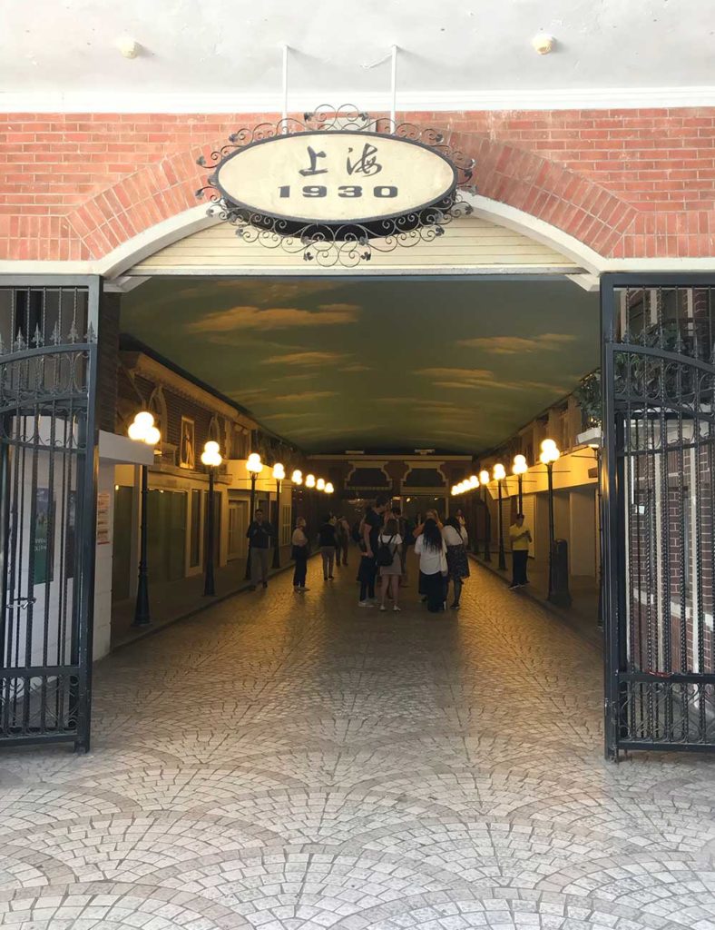
We were traversing the People’s Park (人民公园)when we stumbled upon a staircase with a sign that said “Step back to Shanghai of the 1930s.“ Peering down the stairs, we caught a glimpse of people snapping shots of themselves beside a vintage streetcar and imitation old gas streetlamps. Turns out that the underground passage was an abbreviated recreation of yesteryear’s Shanghai!
Smacks a bit of the Bellagio in Las Vegas, as a stage-set reminder. Merchants have yet to take up shop in the themed storefronts.
As curiosity led us to discover that this historic display connected to the nearby subway station and the Shanghai Urban Planning Museum. Is this museum for nerds or what? On second thought, I thought, this is brilliant! People need to know more how cities come to be — between commerce, history, culture and pro-active government action. They don’t just make themselves; everyone has a role to play in them. And honestly, it wasn’t that nerdy, as we soon saw large groups of European tourists buying tickets. Apparently it has some level of notoriety among foreign tours of China as a cultural magnet.
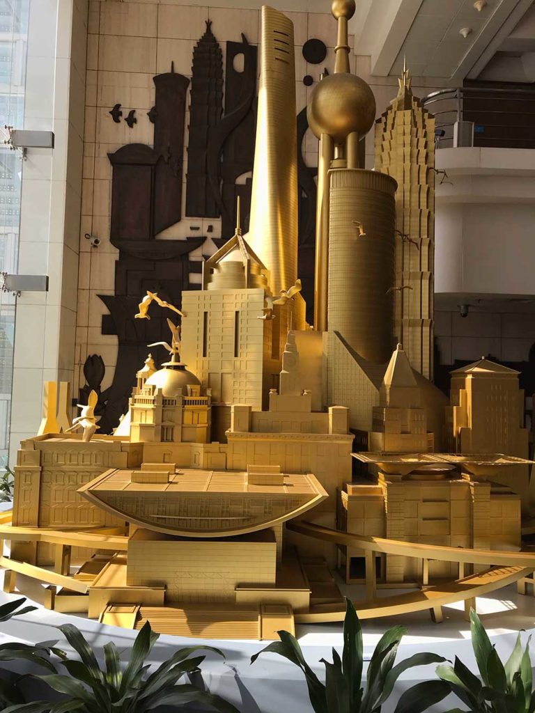
This golden socialist constructivist megalith greets you upon entry into the museum.
The Shanghai Urban Planning Museum, which opened in the 90s, is a prominently large building at six floors tall and explains the past, present, and future of Shanghai through urban design, sewage and environmental impact mitigation programs, water and energy supply systems, transportation, and homes for future growth. For a citadine, this is everything you don’t see but count on to work.
One of many old photos of past Shanghai life on display. Not sure if this was staged, and not surprised if it is.
(AN ASIDE: The first time that I discovered my fascination with the invisible mechanisms essential to the health of a city was when I was 18 years old. My friend Ashleigh and I got stuck in downtown San Francisco after the last BART left and decided to wait out the two hours before the arrival of the first train in the morning. During those hours, as we huddled on a park bench at Powell Station, I recall witnessing city crew emptying all of the street trash cans on Market Street, power-washing the sidewalks, illuminating burned out streetlights, and patrolling the streets for irreverent activity. It was then that I realized that a great army of silent, assiduous keepers tend to the health of the city, whose existence, until that moment, was oblivious to me.)
Multi-media, Multi-disciplinary Content
Never having set foot in an urban planning museum before, moreover encountering one, my parents and I ran on curiosity. The museum encompasses the arc of recent Shanghai history, emphasizing the Qing Dynasty and the European Concessions post-WWI. The media is diverse — from blown-up black and white photos, recordings, dioramas, 3-D wall graphics, and video. For example, we saw miniature layouts of the estates of the governor — in particular, Yu Garden ( 豫園 or Yu Yuan) as a miniature with mechanical figurines, lights, and sound. Originally an estate of the Pan family during the Ming Dynasty (late 1500s), the sprawling collection of pavilions and interstitial gardens passed hands over the centuries to caretakers of varying levels of conscientiousness and neglectfulness. At present, it has transformed into a grandiose network of shops, restaurants and galleries. So many of China’s former esteemed and exclusive estates and neighborhoods find resurrection from dereliction through new incarnations as outdoor malls. Considering the amount of artisanal and material support necessary to fund the maintenance and access to these historical treasures, the funding must come from somewhere if not public coffers. The money comes from consumerism and capitalist stewardship.
Yu Yuan is now a shopping destination.There’s a ton to taste in Yu Yuan, from affordable snacks to extravagant, full-fledged banquets.
As the pre-eminent Chinese cosmopolitan, Shanghai embraces a magnitude of dynamism and drama of which this large museum only captures a small fragment. And its attempt is remarkable. The third floor features an all-consuming hand-made model of the city, updated every year to account for its constant change. It is just incredible.
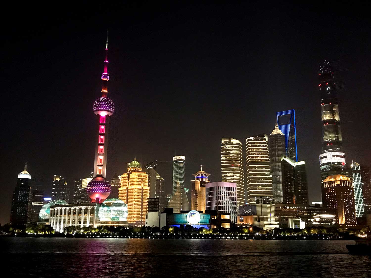
The Huangpu River (黄浦江) separates The Bund (外滩, Waitan) on the west bank from Pudong (浦东)on the east bank.A ramp encircles the intricate model, for your viewing pleasure.Lit in blue light is the downtown area. Concentric rings of roads and freeway provide access. Ultimately the subway and bus system prove to be how most get around town.
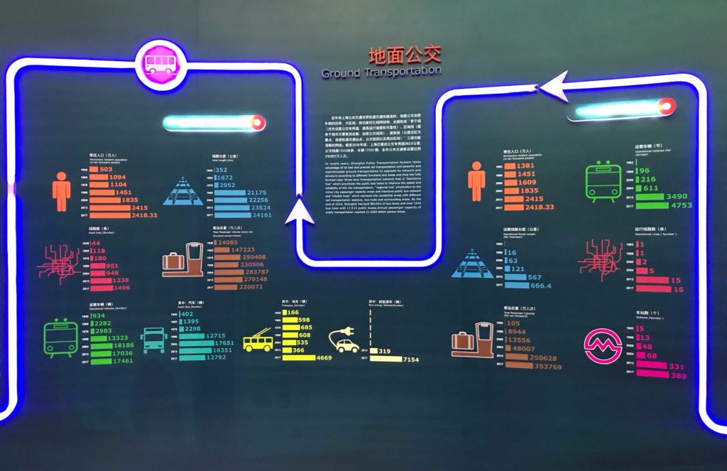
The Transportation Floor
My personal favorite floor is the fourth, dedicated to the Shanghai transportation. Systematically, it accounts for all modes of movement, from pedestrian to bike to bus & rail to taxi to private vehicles to ferries to ships to airplanes. The lighting takes the form of its subway line map. Its position in “the sky” is homage to its value in society, “illuminating” all that people can see and do in the city. The graphics are colorful and the facts practical and delivered in a friendly manner, conveying with clarity a system that is meant to reach quantifiable benchmarks of service. The visual language of the transit system is borrowed, to guide the viewer through the exhibition.
Yeah!! The Shanghai bus system is swift, with high frequency, arriving every 5 minutes during peak travel times in the downtown areas. They move in and out of bus-only lanes. Onboard announcements of key bus stops are in Mandarin, Shanghainese, and English. Drawing the relationship between population and the supply of road space and the options of modes of transportation from 1940 to 1917.Aside from human movement, freight is a huge part of the transportation system and consideration.
Everyone’s a Seasoned Transit Rider
The Shanghai mass transit system not only is the backbone of getting around town for everyone, it also helps people map the city in their minds, even in this phone-addicted era. The average Shanghainese’s awareness of the mass transport system is enough to give rescue to a lost tourist. In fact, while at Yu Yuan, we asked a man how to get to the neighborhood of our hotel by bus, and the location of its nearest stop. He told us without hesitation: the 93 or the 209 buses up the street through three intersections and hang a right. Another notable commentary is the average Chinese person’s idea of “walkable distance.” Often, they’ve described a destination as a “short jaunt away” which, in real terms, was 1 to 1.5 miles away. Your average Angeleno would freak out at this interpretation.
Transportation as Part & Parcel of the Larger Urban Design
The exhibitions demonstrated that the boundaries between transportation, commerce, private vs. public space, natural resources, and population are porous, illustrating a compelling complexity of the inter-dependencies. In fact, the information seemed to settle on the fact that population is the main driver of infrastructure development in Shanghai. According to the exhibition, the population of official residents will be capped at 2,500,000 which should be reached by 2035. The birthplace of the One-Child policy, China would naturally carry out such a population containment mandate in its biggest cities. Nonetheless, it aims to ensure a certain quality of life for both individual and city.
I can appreciate that the urban planners and government of Shanghai invested in exhibition design and curation to declare these bold goals and plans, and make the effort to endow the public with this knowledge. Again, back to that fateful night in San Francisco, I think it is important to make visible the invisible workings of the city so that people know what it takes, can appreciate the quiet and constant effort, and ultimately, pitch in when their participation is needed.
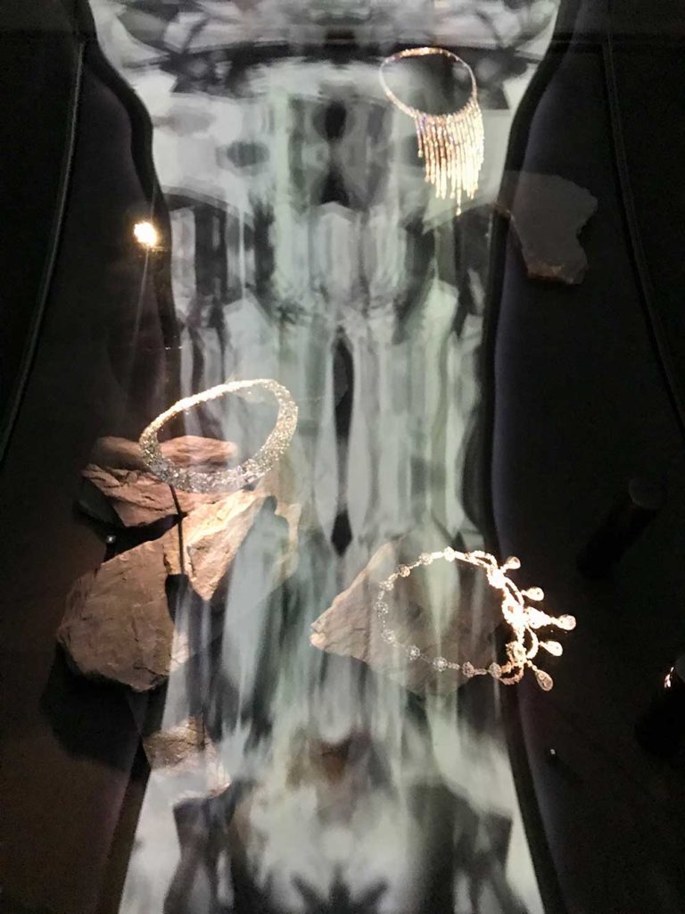
Fosun is an international corporation based in Hong Kong. Like so many lucrative, large companies, they set up foundations for public benefit. Here in Shanghai, the Fosun Foundation is a museum featuring rotating art and culture exhibitions, such as the Tiffany’s show which we caught.
Fosun Foundation, which is located on the southern stretch of the Bund, in the Design Center.
I’m not even a fan of jewels and diamonds. At first, I was disappointed to find out this subject of the show but my dad is ticket trigger-happy so before I could protest, he had already purchased admission. I’m glad he did! My disappointment quickly dissipated when I saw the stellar quality of the exhibition design. It was sublime and received international rave reviews. Every room is uniquely designed with attention detail, right down to the tiny, pin-prick lights that preside over each piece of jewelry in their cases.
The star of the show was the yellow diamond. A giant thumb-sized rock enchained with more diamonds.
My favorite exhibition hall, this room featured deep, Tibetan chants with electronic percussion, like sounds from the center of the earth where diamonds are forged. The display cases undulated. They were not flat. At either ends the cases contact perpendicularly walls of mirrored glass, so the perception is that the waves extend to infinite on either end, like the looping music. Even the matte black walls of the room are faceted and not flat. The jeweled artwork rests on shards of black carbon. Overhead, motion graphics of chrystalline facets float slowly and ceaselessly, forming new configurations.
I will forever remember this show for its craft, thought, and beauty — all exuding with generosity. The exhibition captures what I believe design is at its best: a multi-sensorial aesthetic experience in which communication, education, and pleasure emulsify into one cohesive delivery.
I’m on vacation with my parents Sichuan Province, China. They love marauding for tales of the past and for delicious eats. I tag along for the surprise, and this visit to Dujiangyan definitely qualifies. We arrived from Sichuan’s main metropolis, Chengdu, via long-distance bus in less than an hour’s time. (You can actually also get there by subway but there are few scheduled runs.)
Though nearby, the environment feels totally different here. For one, nature abounds! The rivers that run through it are turbulent, alive, and the color of creamy jade. The bridges are richly adorned, oft bedecked with carved halls and terraces — clearly the residents’ ode to their relationship with the waters below.
View near the entrance of the Dujiangyan historical irrigation site.
Everyone here is super chill and nice: Smiles and patient advice are delivered generously. It is said that the taming of this river blessed all of the residents with a more relaxed outlook on life. The people here openly welcome domestic and international tourists who come alone or in caravans of tour buses to see Dujiangyan, this UNESCO World Heritage site. How did folks here turn out to be so exceptionally nice and knowledgeable?
It is said that this region had a significant transformation 2,250 years ago. Established before 250 BC, when China, was just getting consolidated into one empire (the Warring States Period), a notable example of irrigation infrastructure was brought into being by the then governor of the region, Li Bing (李冰), and his son.
Foldout of the tourist brochure, showing the entire irrigation system site.
The river that ran through this farming village would swell ferociously every year, wiping out everything beyond its banks. The floods hampered the village’s ability to grow into a productive agricultural and economic center, and stressed out everyone.
As the largest tributary of the Yangtze River, the Min River brought lots of silt and sediment each time it swelled, exacerbating its magnitude of damage in future occurrences. Attempts to mitigate it failed until finally, the Qin Dynasty King at the time, 秦昭襄王, awarded Governor Li this task of figuring out a way to control the floods. He also gave him a huge budget.
Li could’ve perfunctorily built a dam, which may or may not have worked, and, in fact, several unsuccessful dam designs preceded him. Having an engineering background, he conducted a thorough study of the local snowmelt phenomenon, which led him design a different solution: splicing the river and creating channels in specific locations that diverted the floodwater to other parts when they accumulate above a certain level. This way, the water was kept within its banks and the excess was used for irrigation. Creating this system was a monumental task because tools were pretty basic back then. There was only manual strength as gunpowder had not yet been invented. The river water is fresh snowmelt and therefore freezing cold. No one in China had ever created a flood control/irrigation system like this before.
But before he could even embark on the engineering, some “community outreach and engagement” issues had to be addressed. The Shu tribe who resided in the area saw the river as an omnipotent deity and lived in fear of it, even drowning two Shu girls in the river each year as human sacrifices. They would never dare to support an intervention of altering this sacred river. Such an attempt would not only be crushed by the river deity but would rile its immense and deadly rage.
Governor Li and his staff figured out a creative mythical performance and stunt to subdue this fear and earn the Shu people’s conviction that he was a sort of Chosen One. Steven Mithen, in his book, Thirst: For Water and Power in the Ancient World tells the full story.
Once the public confidence was earned and the crucial human workforce promised, innovative engineering methods had to be devised in order to realize this masterplan design. For example, a channel had to be carved out of the side of a mountain which was entirely of rock. How did they do it without dynamite? By exposing them to extreme heat and cold over and over again, they were able split these boulders and rocks. They would burn wood and grass into every crevice to heat up these big rocks, then subject them to the icy water, in repetitive succession. They fissured and the workers chiseled away the debris. It worked!
An artificial island needed to be built in the middle of the river with a pointed tip that would split the oncoming flow in two. At first, rocks thrown into the middle of the river, no matter how large, would just get washed away. Finally, they devised a successful means: tubes of river rocks bundled together with woven bamboo strips.
At the confronting tip is a massive concrete and stone protuberance named Fish head or Yutou (鱼头) and is quite the tourist site today at Dujiangyan. It is magnificent to see in action.
The Yutou is visible on the right from this view, taken from the tower balcony.
To prepare the secondary “alternate route” for the river, Li’s team had to create dykes and levees to block and contain the water during this process. Again, the invented river stone bundles were implemented and held in place by three-legged bamboo “easels.” Some are on display today.
Example of the structures actually used for dyke and levee construction. They were installed by the hundreds.
To allow foot-traffic access to and from the island, a rope bridge connected it to north and south banks. The suspension bridge has been reconstructed numerous times over hundreds of years. Walking across the clacking wooden planks held together by thick rope, you’d think it was the original but this one is only the latest rendition of a few decades ago. True to spirit, crossing it feels ancient and unlike any modern bridge.
The moist fog and the dense forest setting made the setting so pleasant and the scenery so atmospheric and romantic. You can see nearly the entire levee system. Only the irrigation channel that was dug into the facing mountains was nestled out of sight. I wanted to see this too but the Anlan Bridge access to that side has not been restored, preventing pedestrian access.
On the other hand, once onto the south bank, you can hike to several temples, towers, and monuments, including the stately Erwong Taoist Temple.
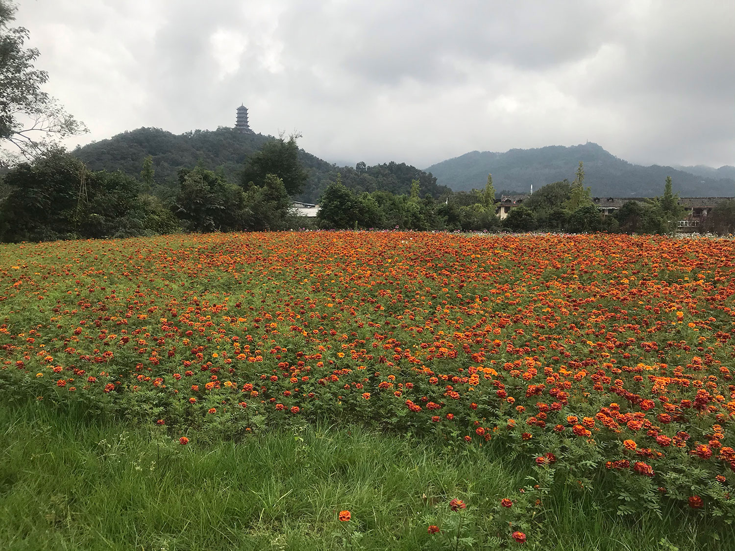
A field of marigolds with temple in the distance.We only reached Qinyan Tower.
Being that my parents are both in their 70s, we didn’t venture all the way to the temples. Instead, we zigzagged our way up steep stone stairs for 20 minutes to the Qinyan Tower and contented ourselves with this feat by admiring the views from its balconies.
To this day, Governor Li remains the hero of Dujiangyan. My parents and I strolled across the South Bridge (南桥) to the Old Town streets chock full of eateries and shops and graced with distinctive water channels.
The entrance to the South Bridge (南桥 or “Nan Qiao”), completed in 1878, severely damaged in the Wenchuan earthquake of 2008, and subsequently restored.The South Bridge is an arcade structure with brush paintings and poetry in calligraphy written on the ceilings and walls inside. At night, colored lights transform its appearance. Here I am, on the bridge. Famous traditional poems, paintings, and motifs are on the interior surfaces. The flooring is hard dense wood.
On the other side of the bridge is a historical shopping center. Roads, sidewalks and buildings remain largely true to the past.
When the rivers rise to a certain point, water is siphoned off in a myriad ways, including through exposed channels along streets. They are beautiful to see. The channel beds are of sand and stone, allowing for irrigation and permeability into the soil below.
The city has installed wall etchings of old photos of this same street 100 years ago. They were mesmerizing to stumble upon.
Illustrated walls like this one are hidden and scattered throughout the old town, ready to surprise and intrigue pedestrians. In this one, you see the Tibetan trader with his yaks coming into town (on the left) and merchants conducting trade on the right. Everyone looks so thin! Life must’ve been harder back then.
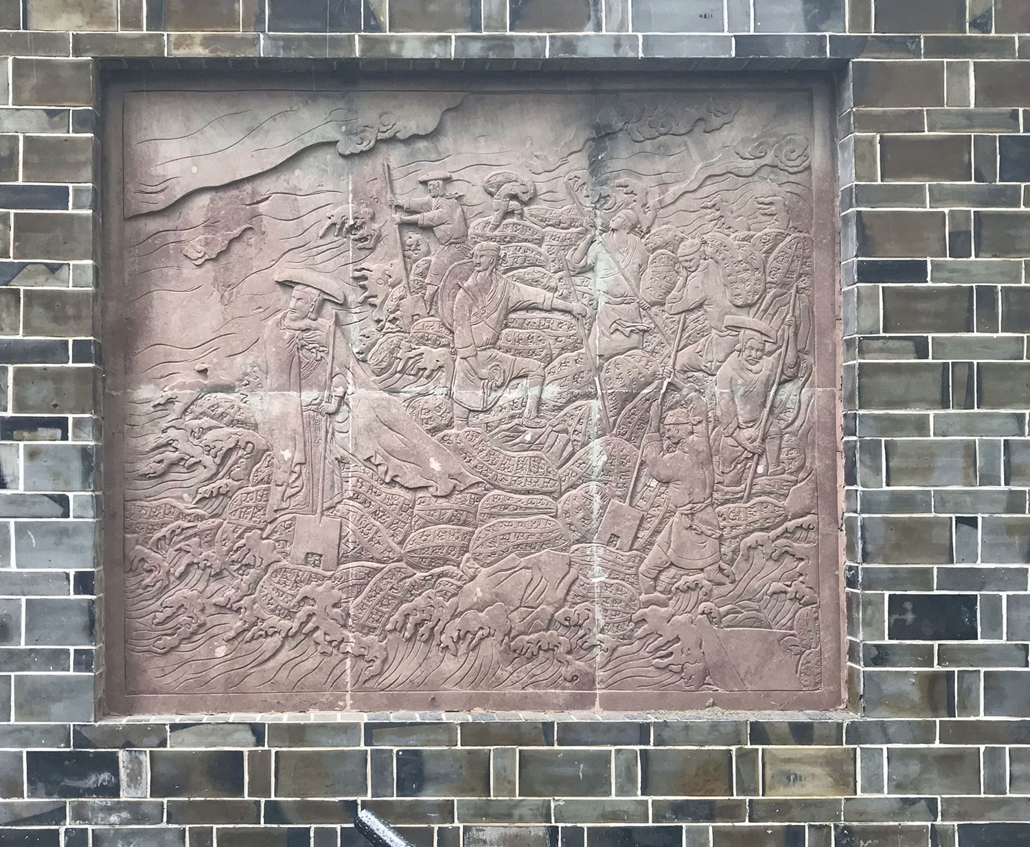
Among these surprise visual accounts of history were reliefs, carved narratives, depicting Li Bing and his teams subduing the Min River.
The throwing of numerous bundles of rock into the water to create an island.Carved stone relief of men digging into the water
I noticed the stain of grid on the artwork and suspected that it was the result of being boarded up for its protection during the Chairman Mao years. At that time, citizens and Red Guard destroyed as much evidence as they could of ancient and imperial China as part of the Cultural Revolution. This beautiful stonework record would’ve fallen victim to the rash tempers of history had not earnest hands swiftly shielded them. Today, the blemishes only augment impressions of past dramas and triumphs that have swept through Dujiangyan, with promises of more to come.
After much walking and hiking, we took advantage of the eateries in the nearby Old Town. Condiments (such as Sichuan peppercorn and all kinds of mushrooms and root vegetables preserved with it) as well as ready-to-eat foods abounded. It was both a tourist and local hotspot. A great way to refuel.
Different foods but all spicy.Steamed buns made from various coarse grains, fresh hard-boiled eggs, and steamed dumplings.Steamed buns, corn cobs, sweet potato, and sausage links.My parents enjoying Dan Dan Noodles, a local classic.Fresh tofu being made right before your eyes. Chicken wrapped and fired in clay. The clay also keeps it warm until you are ready to eat it by cracking it open with a metal spoon. Very juicy.Mysterious and exciting, as I will remember Dujiangyan.
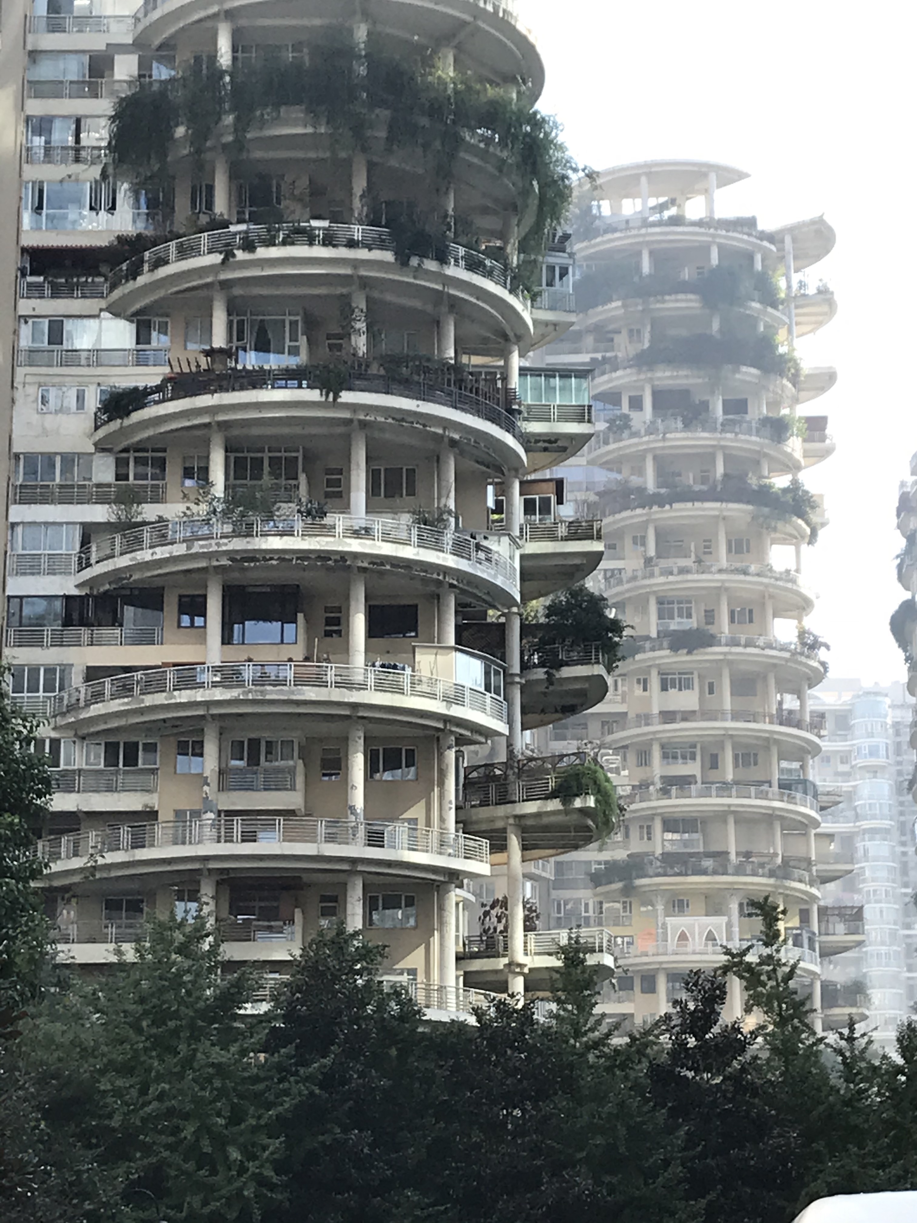
As cities see more and more skyward growth, from highrises over single-family detached homes, the value of space also experiences astronomical escalation. Like São Paulo and Buenos Aires, China’s megacities are comprised of towers, where people live in high density. With much less private space at home, the realm of public space and community centers — whether covered or open air — becomes really important.
In Chengdu, one of many clusters of highrise units that fill the city.
Public parks become requirements in a city, as means of promoting physical and mental health, and as sites for cultivating community and individual happiness.
From what I have seen of Chinese parks or 公园, there are similarities but also differences in how people use them. Exercise is definitely a major reason for people to use the park but the types we see are different, between Chinese and American parks. For one, soccer and basketball are activities reserved for the 球场 or sports fields. Exercises you’d find at Chinese parks include Tai Qi and martial arts, ballroom-dancing, bird-walking, calligraphy practice with broom-sized brushes, poetry reciting and singing, and fashion catwalking practice.
Loci of Activity & Fitness
If I think about what I do in my house in California, I cook, garden, do laundry, eat with family and friends, and hang out and chat. If you live in a compact high-rise apartment, these activities become more challenging. Gardening and exercise may become impossible unless you have a balcony and extra space, and not all apartments have them. Ideas about communal laundry (the laundromat as a community center) and about communal gardening (like in many cities in the US) suddenly become really relevant. Open space itself is a meditative and therapeutic resource that appeal to our basic urges.
In fact, the design of the Chinese public parks lend themselves to these activities, with clusters of trees demarcating zones. Hardscaped (concrete and stone mosaic) pathways and plazas provide the surface. Surrounding tall foliage create walls or transition zones between open spaces. The parks themselves are usually free to the public and have multiple entry gates. The park space itself is quite large, like all infrastructure in China.
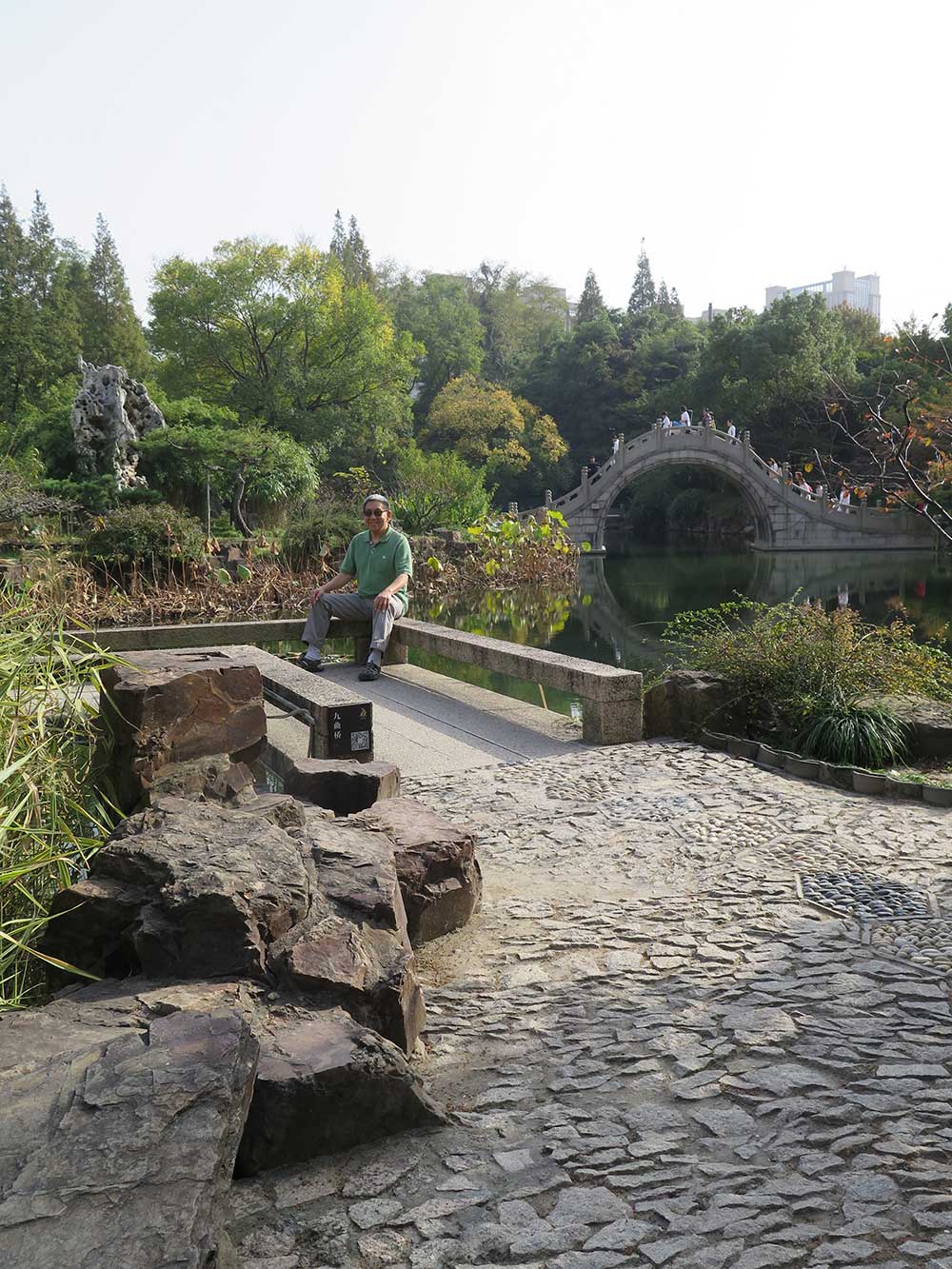
My dad taking a break at South Park, 南园,in Taicang, 太仓, a city one hour from Shanghai. Many former estates, such as this one, are converted into public parks. A classical Chinese bridge with its steep stairs and generous clearance for boats is visible in the background.
Tertiary zones are characterized by benches and pavilions nestled in the foliage, creating smaller, private spaces for drinking tea, casual conversation, and the occasional smooching. Often times, the park features one or more artificial lakes with a bridge arching high over its narrowest part, offering a view and opportunities to take selfies with friends.
A Social Hub for Passive & Active Participation
The park is never desolate, even on the weekdays. It is a social locus, providing both distance and respite from the bustle and chaos of city life while ensuring some level of safety and society amidst the presence of others also usually in a state of enjoyment.
The buildings now house exhibitions and artwork. People practicing slow-motion combat, a kind of Tai Qi, where you harness the strength and force of your opponent to protect yourself. Here, men and women of all ages show up and practice together. It is pretty informal and still quite popular. Offline dating. Here, parents and elders advertise their single adult children to other parents or single people. The flyers atop the umbrellas give general information about the individual: Gender, profession, interests, and personality. At the bottom is contact information. Of course, you are welcome to inquire further with the presiding relative.Sunday morning in the walkways at People’s Park in Shanghai. Parents helping their adult children with matchmaking. Generations sharing ideas of what comprises a promising partnership.
Gehl Architects — One of the biggest challenges that Chinese cities face is in the reclamation, renewal and retrofit of its cities’ public space, streets and existing urban fabric. The speed, scale and sprawl of Chinese urbanisation has void many citizens their right to quality public space beyond the immediate street layout. To achieve the sustainable transition we’ve talked about here, cities will have to ask themselves – what do we want from our urban realm? And how can our planning systems deliver that against traditional interpretations of urban scale, mass and historical and cultural nuances? Cities need to be evaluated based on other indicators than just GDP growth. We see this change happening now.
Park-like Shopping Centers that Support Historic Monuments
The park as a concept is more important than its literal designation. As an idea, it seems to be a place that provides proximity to nature (plants and animals), contact with open air and earth, and organic social interaction through a flexibility of activities. To this end, I saw many spaces that operate as parks but may not be parks, per se.
In Chengdu, Taikooli ,太古里 outdoor mall features both very contemporary and very old architecture. The balanced proportion of indoor and outdoor space make it a popular gathering spot for all ages. Owned by a private investor, it shares similar usage to state-run public parks.At the very center of Taikooli is the ancient Daci Temple 大慈寺, the Temple of Infinite Compassion and Mercy. This Buddhist temple has been around for nearly 1,600 years
For example, an interesting trend I spotted was the integration of historic landmark, shopping center, and park all rolled into one. These outdoor malls feature austere architectural design, vast open spaces for social activities such as those practiced in parks, porous access, and mature landscaping. The business rationale behind such a set-up could be economic viability. Landmarks are expensive to maintain and admission fees are too low to make a dent in these costs. However, retail rental income can provide a stronger source of revenue, with shops increasing incentive for visits. Inviting the kind of hanging out that also occurs in parks encourages discretionary spending; however, the full suite of typical activities in public parks may be beyond the physical scope of these commercial gathering areas.
After a day of shopping, you can light a candle at the temple and make a prayer to repent and enrich your spiritual self too.
Medians as Parks
Other atypical park spaces include the generous medians and lush pedestrian walkways in the city. The non-car zones are often canopied with trees and lined intermittently with benches with nestled in abundant greenery. These adjacent, liminal spaces are used for resting, hanging out, reading, and other low-impact park exercises. Their physical and sensorial distinction from the built environment provides mental sanctuary.
The greenery surrounds the bike and pedestrian lanes, creating a park-like travel experience. The dockless bikes collect in a leafy alcove. In the distance to the right, cars along the street are visible. The amount of garden foliage and number of trees are generous.
Public dancing occurs in plazas, on sidewalks that are extra broad and in parks. These kinds of natural, serendipitous social gatherings are more of a cultural ritual than a designed program. They attract spectators and participants in equally, creating vibrancy and free-of-charge entertainment. They also provide a glimpse of local culture unchained to commerce and to politics. These benefits can counter-balance the limitations of high-rise apartment living and strengthen the fabric of communities.
Urban planners can think about creating park-like locales and experiences in interstitial and liminal zones as space becomes scarcer in urban settings. Not every neighborhood can afford the extravagant space needed to establish a formal park. Plus, such numerous and smaller dispersions encourage accessibility for a greater number of residents. This may also be a more “human-scale” approach, rendering the urban layout to be more diverse and reduce impact on the transportation system.
Unabashed dancing takes place in parks and on sidewalks that are large enough to allow. Shyness is not an issue. Informal gatherings with those who are in the mood to dance.
This past Saturday morning, I had to get to Plaza del Valle in Van Nuys for a Metro community event. Two journey options: one achievable in 28 minutes by car and the other, 1.5 hours by transit, and I chose the latter — and that has made all the difference.
Why, Eileen, why?
Manifold reasons:
1. To get a chance to ride the amazing Metro Orange Line for the first time.
2. To reduce polluting emissions into the air.
3. To get an up-close tour of neighborhoods new to me.
4. To relax and leave the driving to a pro, and avoid affliction with road rage.
5. To have an adventure.
The pressure to catch the 501 bus afforded some benefits. My dear garrulous neighbor ceased his sidewalk effusion when I mentioned I had to catch this once-per-hour bus. Off I sped, on my bike from home in East Pasadena to Raymond Avenue and Walnut in old town. One beat after my bike lock clicked into place, the bright orange of the 501 Metro Express from Pasadena to North Hollywood bus loomed on the horizon. The actual stop was only ten paces away, which I covered with an alacrity that, I would soon discover, is essential to getting around LA on mass transit.
The speed of the 501 on the 134 East at 9AM on a Saturday morning is totally impressive. With free wifi onboard and plentiful seating, my satisfaction became pure delight when we rolled into North Hollywood Station’s lot a mere 20 minutes later.
I had to ask a stranger for direction to the Metro Orange line connection. It was across the street and, according to the LED sign, required a four-minute wait for the next one. First time on the Orange Line, I was practically shocked by its frequency and the pleasantness of traveling in a bus-only lane mostly secluded from car traffic and parallel only with walkways and verdant foliage. It was immensely tranquil and efficient. About 15 minutes later, I arrived in Van Nuys, where I would wait 10 minutes for the 233 Local bound for Pacoima.
As I boarded this bus, the atmosphere was more of the familiar Metro experience. At nearly max occupancy, this included a lady with a wagon full of boxes in the Seniors/Disabled priority area. A man was blasting ranchero music from his smartphone, while others grimaced and endured. The neighborhood whizzed by through the windows: auto shops, neverias, pawn shops, mom and pop taquerias, county aid offices — signs of a neighborhood trying to get a foothold on LA life in its own way. Engrossed in studying the surroundings, I missed my stop and overshot my destination by three miles before I snapped out of it. At that point, I decided to get off at the next stop, cross the street, and ride the 233 in the opposite direction to my original destination.
My Transit app and Google both said the wait for the next bus would be ten minutes but, even after three minutes, the wait remained a steadfast ten minutes. My finger yearned to open the Lyft app and be done with it but I held out. Soon a few other riders appeared at the stop waiting for this bus. I noticed one girl count perfect change in her wallet and I decided to give her one of my extra TAP cards in my wallet. As I explained to her what a TAP card is and how it would help her save money, she nodded but her eyes conveyed blankness. I realized that getting the point across is not as easy as I had assumed. She stared at the card that I gave to her with a look of “What in the world is this?” I realized, she needed to hear it in Spanish.
Eventually the bus came and I rode it back. None of the buses have a digital map onboard that shows where you are on the route, at any given time. Furthermore, the apps don’t have a way to tell you where to get off the bus. The onboard announcement of forthcoming stops are consistent, muffled but vanquished by the ambient noise. You just end up having to look out the window and count the stops very carefully.
Getting to the actual community outreach site was not easy. This downtown Van Nuys area looks like Ensenada to me! And the visual inundation was obliterated any temporary signage that Metro may have put up to attract passerbys. Eventually, I found the coven of white tents and was able to identify my Metro colleagues.
Without going into too much detail on the Van Nuys new light rail line, pedestrian walkway, and bike path improvement public engagement event (which was a blast and such an improvement over typical civic meetings, the details of which I wrote into a report for my Metro work), I’ll just say that taking Metro there gave me an authentic and insightful exposure into the people, cityscape, and overall vibe of Van Nuys Boulevard. This was crucial information for participating in the outreach event with the public and for evaluating the effectiveness of our informational material. I certainly would not have gotten that if I had driven there.
The ride back was not bad. The 233 arrived just like the Transit App said it would. However, when I got to North Hollywood, the app said that I had an extra ten minutes before the 501 would depart for Pasadena. As I leisurely strolled towards the sun-drenched stop nearly three blocks away, I spotted it, to my alarm, pulling away from the stop and already exiting the bus terminal. OMG WTF! I didn’t care whether the app was wrong or if the Metro bus operator decided to take off early— I just did not want to wait 40 minutes for the next one.
Remember the essential alacrity that I mentioned earlier? This is it. Recalling that the 501 took Lankershim Boulevard on the way over, I knew that it would take it going back, making one more stop before blasting itself off to Pasadena… and my hopes to oblivion.
I bolted down the street, thanks to a combination of my favorite Converse sneakers and my 40-something machinery that won’t let up. Fortunately, the 501 was hindered by a series of red lights behind me, but soon enough I was neck and neck with it at the last intersection preceding its last stop.
I turned my head and looked at the bus operator through the bus door window. She seemed to detect the searing energy of my beseeching glance and turned to me. I pointed to the bus stop across the street. She nodded and gave me a thumbs up.
Of course the bus got there before for I did, but not by long. She held as I ran up. Breathless, I put placed my Metro badge on the farebox TAP validator. “Thanks.” I said to her. “Never give up.” I said to myself.
I love the 501 for whizzing past traffic and just shuttling between its destinations. Pasadena arrived to us faster than to any driver from North Hollywood.
Yes, that roundtrip did take time but I got to see, learn, and experience a lot. I had that hunch all along. It was an investment and a luxury that we each decide whether we want to have.
This past Saturday morning until noon, my friend Michael and I, along with about 100 others of all walks, participated in a public tour led by the Los Angeles Department of Sanitation at Puente Hills Landfill and San José Creek Water Reclamation Plant.
I was very excited to attend this tour because, five years ago, I worked with Los Angeles Department of Public Works (LADPW) on a publication called the Countywide Siting Element, an integrated waste management plan for the County for the 10.16 million residents. The document made it clear that the County was running out of local landfill space. That time has now arrived. It had all been in the abstract until now.
The Landfill Tour
Puente Hills Landfill, the largest in the USA at 600 acres across and up to 500 feet deep, is now closed and no longer receiving dumps. The trash items are encased in a concrete-lined basin and buried at least five feet deep in soil. No water penetrates it. You can see a tree-studded mountain off of the 60-freeway.
It looks very natural but as you get closer, you see that the trees are all non-native: figs, eucalyptus, myrtles, with pipes, full of liquid leakage or methane emissions from the trash, weaving among the tree trunks. You can also see croppings of mysterious tanks and pumps throughout the mountainside. Nonetheless, there are plans to transform it into a public park.
The methane leads to a furnace where it is burned and the heat is used to create electricity. Water is used to cool down the air from the energy conversion and the vapor is released through these stacks.
At the foot of the mountain is a giant warehouse, the size of which I’ve never seen such so large in my life. The big trash trucks departing from them, after unloading, look like tiny dots.
Inside, each truck must pay depending on what it is dropping off and how much. The types of trash are sorted into much more specific categories than just “recycling.” For example: wood, concrete, produce, paper, glass, etc.
After sorting and breaking down the categories of trash, they are either sold or transported by truck or train to distant processing sites.
The Sewage Tour
San José Creek water reclamation services existed before Puente Hills Landfill became a thing. It is the oldest sewage processing plant in LA County and a large one too. Check out these buttons. They don’t make them like this anymore!
San José Creek Plant alone process some 100 million gallons per day. Sometimes, more sewage arrives than can be processed, particularly during storms. In such cases, the raw sewage goes straight into the ocean. A new plan, the Clearwater Project, will have large pipes built and installed into the Pacific, sending sewage a few miles out before it is released into the ocean, so it is away from the coast.
While this preserves the quality of water along the beaches and coastal properties, it does also send a bit of the wrong message: Out of sight, out of mind. Raw sewage is gross.
Our guide and Sanitation employee told us about the three stages of sewage processing.
Primary – In tanks, beneath closed metal doors. Our guide opened some for us to see. It was too dark to see and the smell was too strong to approach.
Secondary- The debris in the water is partially digested and the liquid is exposed to the air to enable further breakdown through natural processes. The odor is strong but less so.
Tertiary – The water goes through intense sediment filtration and becomes clear.
Over 50% of LA’s water is from Sacramento and from the Colorado River. With those sources reducing their exports to LA, we need to curb water waste and, when it does rain, let rainfall recharge our groundwater sources. This means letting it drain into the soil rather than running off into the ocean.
As we face a city and world that is stretched thin for resources and changing as a result human impacts, what struck me the most during the tours was how much fuel and energy we are expending to manage waste. A toilet flushed in Pasadena must travel through a network of pipes to reach Whittier to be processed. Trash collected from a residential bin from Monrovia travels 30 miles in a heavy diesel truck to be sorted and then put on a diesel train to be hauled to Mesquite Canyon Landfill in the Mojave Desert. We are compounding our waste.
Some ways to conserve resources would be: 1. Worm-composting kitchen scraps. You can use the resulting fertilizer for your vegetable garden too. 2. Installing rain catchment bins and cisterns around buildings. 3. Building bioswales into garden landscapes. Grow native plants. 4. Recycling clean recyclable materials. 5. Buy only what you need and making it last. 6. Avoid single-use items. 7. Dispose of chemicals and toxic materials responsibly.
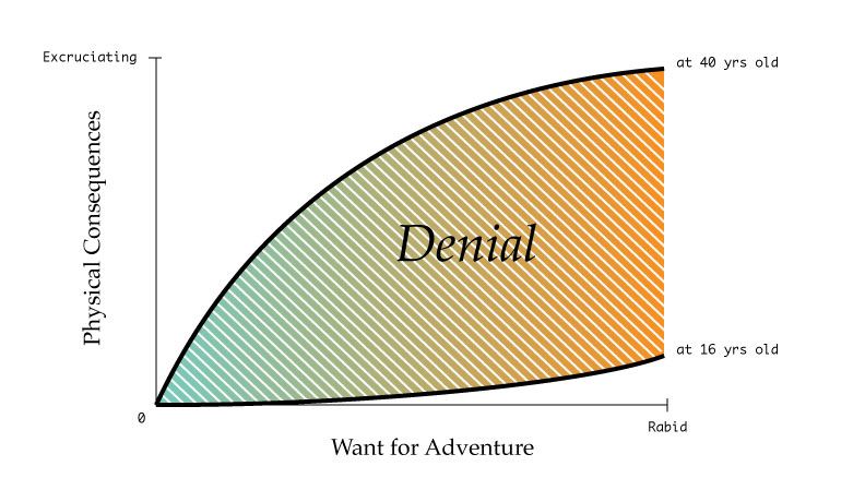
I needed to hit reset by way of adventure, nature, and novelty. It”s so weird that I could actually achieve that in such a short period of time! I”m spending my night at home now, typing on my laptop on the dining table, even though the morning of this very day began atop the Sierras hundreds of miles away. Such is the phenomena of modern life.
Active Transportation
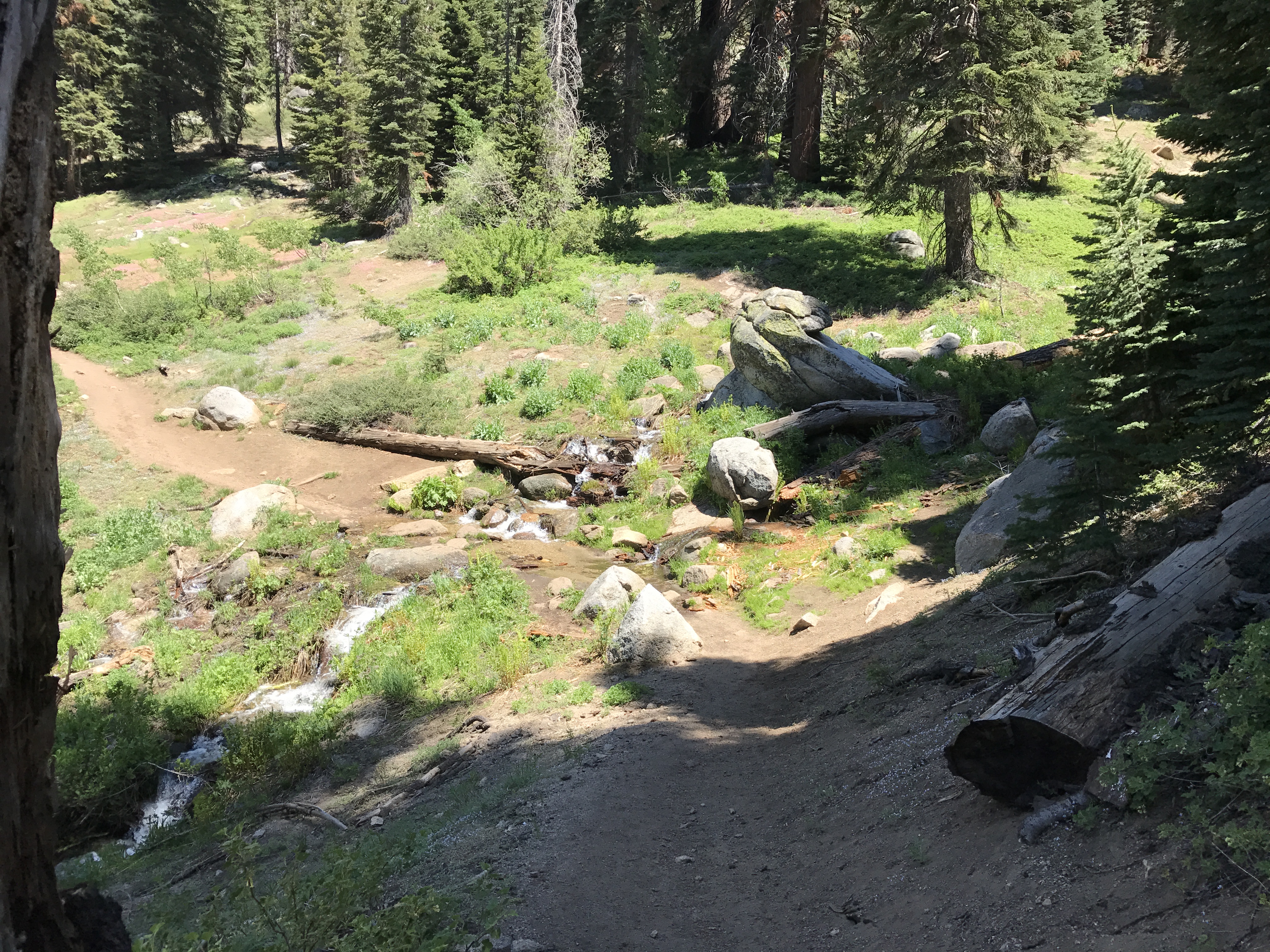
For a mere nine miles, I was my own transportation: these two 42-year-old limbs. It had been a good long while—decades for that matter—since I have done any significant amount of backpacking in the wilderness. While an undergrad at UC Berkeley, I had picked up the pastime, through a student activities organization on campus called Outdoor Adventures. This time, I was going to go backpacking alone for the first time, and for just one night on the Lakes Trail in Sequoia National Park. Destination: Emerald Lake.
Solo
Going at it alone does require additional precautions. I read up on it on the interwebs, and ended up bringing mace, per recommendation of this kindred spirit, Ali Gates.
But why even?
The winter had bestowed an unusual amount of precipitation upon the Sierras. My last trip to Yosemite after a markedly wet winter rewarded me with unforgettable views of swollen rivers and waterfalls and verdant foliage. I did not want to miss the opportunity this year to see the Sierras rehydrated after five years of drought, even if no hiking buddies had time to join me. Plus, the wilderness had been calling me for a long time, and this moment seemed like the right one to carpe diem.
Outbound
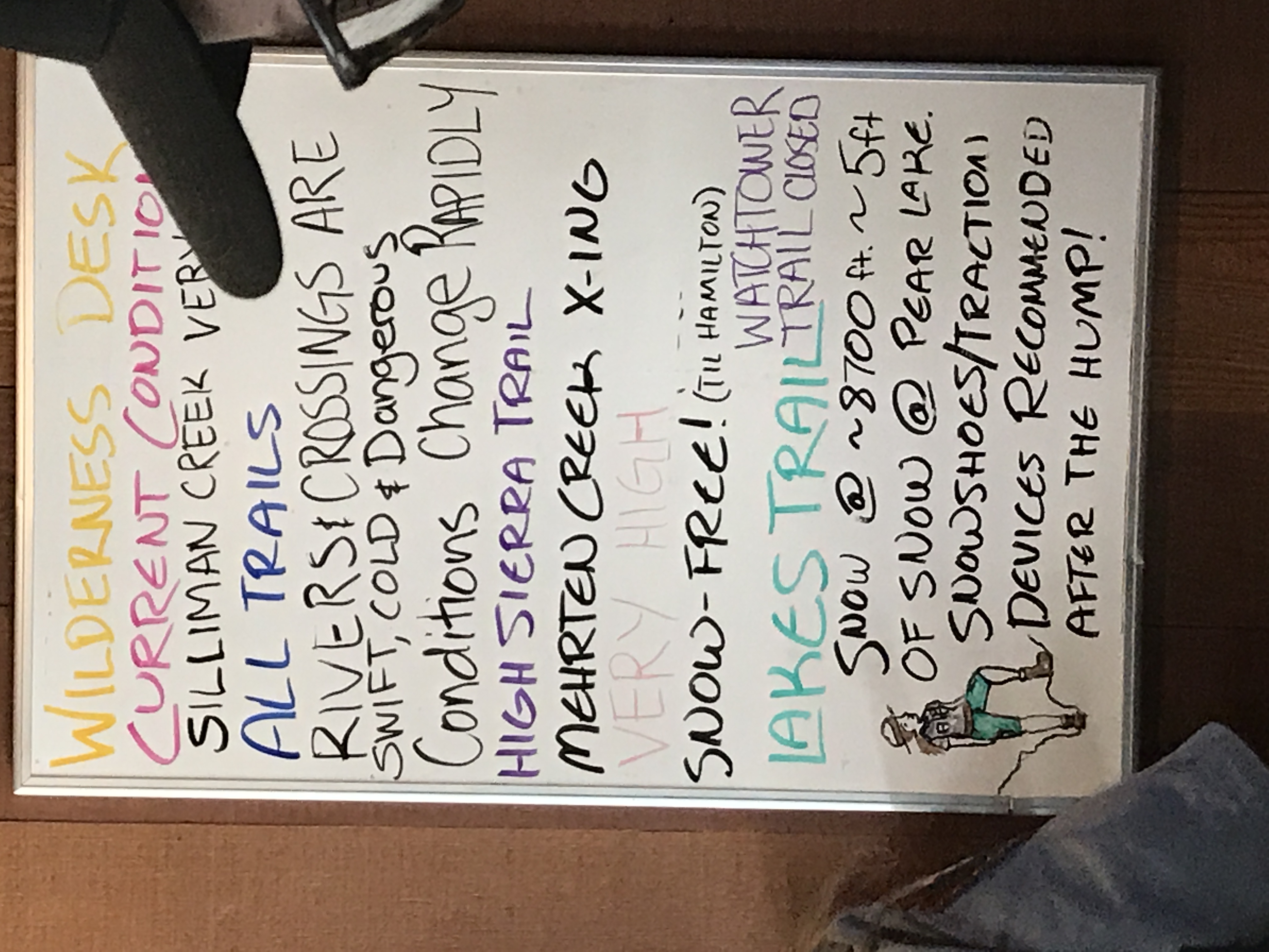
I shoved off from Pasadena midday on a Wednesday and got to Kaweah Oaks Campground in the town of Three Rivers about 3.5 hours later. During the trip-planning phase, I had discovered the Visalia Transit Sequoia Shuttle service, which stops at a handful of pick-up points between Visalia and Three Rivers and takes passengers to the Giant Forest Museum, the heart of Sequoia National Park. For a $7.50 each way, you can leave the 1.5 hours of driving up the windy, construction-ridden 53 miles to a pro. In a way, it was perfect, as the Three Rivers stop is at the town’s Historical Museum, just next door to Kaweah Oaks Campground. I paid the grounds manager an extra fee to leave my car in their shaded parking lot for the night I”d be tenting in the forest. Known as a “cyclist’s campground”, the outdoor lodging is perfectly no-frills. Capacious individual sites to pitch even Coleman-sized tents, plenty of water of the non-potable variety, a common port-o-let, and a common booth shower. If one truly is a cyclist camper, I noticed that each Sequoia Shuttle is also fitted with a rack to carry two bicycles.
That night, bats careened over me, as I walked in the dark from the sink and back to my tent. I prefer to exercise my natural night vision as much as possible, before resorting to the flashlight. It is amazing how many more details you see in your peripheral vision, without the harsh spotlight of a lightbulb. At first, I was a little leery, because I was the only guest at the campground, but by 9pm, company showed up, as in a couple with three coolers full of drink and victuals. They seemed jolly enough. I walked up and thanked them for their presence. They smiled and said no problem, as if there wasn”t ever anything to worry about.Across the street, behind the karaoke bar, the Kaweah River roiled and raged, emboldened by the meltdown of this year’s oversized snowpack. The snarls of current were ready to pull in anything that got close. The overlapping roars created a white noise, that drowned out any sudden sounds that might disturb sleep, if it weren’t for the nocturnal 85-degree heat. Without the respite of a breeze, I lay in my tent slightly sticky.
Somehow, I got through the night, precarious with a heavy-headedness the next morning. Let’s give this a good pour-over of freshly ground coffee beans and leftover Saag Paneer with brown rice from last night. Reheated on my compact MSR stove, it was supremely delicious, elevated by the magic seasonings of my extraordinary fatigue and hunger. Recounts of such details would often perplex or sadden my family members, prompting them to ask why I subject myself to such so-called miseries. In my perspective, these are the small sacrifices for larger gains which, in this instance, was the experience of being in the wild. Oddly enough, I also do achieve a re-calibration of my senses through operating close to baseline. For some, this is deprivation. Regardless, a session of it can make you realize how little you need to feel sated and powered up for the next undertaking.Swiftly, I refueled and packed up, shedding excess materials in my car and carrying the essentials in my internal frame pack, which also contained my sleeping bag, sleeping mat, and tent. As I waited at 6:50am at the Three Rivers Historical Museum for my shuttle ride, a man living in the house across the street walked over and told me that the shuttle is never quite on-time. Silver hair overflowed from underneath his sun-beaten baseball cap. Eventually, we started chatting about life in Three Rivers. He told me that the place had pretty much been caught in a time warp of the 1970s until recently, when milllenials from LA and San Francisco started coming in with their city cash, and driving up the cost of everything, especially property. As they are not showing signs of reproducing, and the native kids are growing up and moving out to the bigger cities, the class sizes at schools have continuously dwindled. He also said that these millenials imported with them their “city politics” and their liberalism. He said he’d rather take capitalism over Muslim proliferation, and at that point I interceded. Perhaps I was yet another manifestation of the liberalism of which he referred (I don’t know) but I suggested that unbridled capitalism is not the way to go. After all, even good old Sequoia National Park, the glory of Three Rivers and the balm of over-frenzied city dwellers like me, was on the chopping block, under the prevailing administration. He paused, and said, ok, then we have to have a third choice of moderation. As I nodded in agreement, the shuttle pulled up and I waved goodbye to the conversant neighbor. Transferring to one of the free Seki local shuttles connecting the Giant Forest to Lodgepole Visitor Center, I would obtain the wilderness permit there for my Lakes trail. Since it was one of the few trails whose permit is only available on a first-come, first-serve basis, I wanted to maximize my chance of securing one by getting there as early as possible, which was, by now, 9AM. As luck would have it, Sierra Swinney, the ranger, assigned one to me for a fee of $15 and took notes on the description of my tent, pack, and emergency info. She also gave me the scoop on the trail conditions and the depth of the snow towards the lake. She had a natural and outdoorsy ruddiness, with glowing complexion and a lean strength to her build. Sierra assured me that it was safe for me to backpack solo and that, in fact, she has to backpack alone regularly on various trails for her job.I also rented a bear canister, where I would store my food that night in the forest. These sturdy bulky plastic cylinders have tops that pop open with a turn of a coin or screw driver. Bears cannot get them open no matter how they kick and bang them. Some forego using these and opt to do a bear hang instead, which is a method of hoisting the sack of food with a rope over a proper tree branch 15 feet off the ground. The only problem is, you may not have such the ideal tree branch arrangement where you set up camp. Taking another Seki shuttle from Lodgepole to Wolverton trailhead, I unloaded even more excess baggage and left a cinch-sack full in one of the several bear lockers that every trailhead has. It’s always hard to figure out how much you’ll eat out there but, more often than not, you eat less than you think and you feel burdened carrying the leftover.Hitting the TrailNow, the pack weighed about 30 lbs, which is kind of a lot, especially considering how constant and difficult the ascent was. The trail started out with partial shade, surrounded by many decomposing fallen pines and firs, and dry, hot air, perfumed with sawdust smells. As I proceeded further, I neared creeks, which gave life to tall grasses and delicate blue belladonnas. The moisture cooled the air here. Butterflies of variegated colors and patterns fluttered. The nice relief countered the increasing difficulty of planting successive uphill steps. Along the trail, I sporadically crossed paths with other hikers of all ages and nationalities. Many were day-hikers, doing the roundtrip in one shot. There was also a solo backpacker lady returning from her trip, bouncing down rocks with contentment.How could one not read the allegory in this backpacking trip? Life is like a long hike and we get so focused on executing the routine that we don”t lift our hands to take in the beautiful environment. It is like life in other ways too. Everytime you reach a lake or a vista point, the anguish of the physical journey disappears instantly to make room for feelings of pleasure and joy. You become glad that you stuck it out to this point. It”s also like life in that responsibilities or chance may pull you in one direction or another.
I crossed babbling brooks and clambered over large fallen logs. Many rest stops slowed my ascent. As I got higher, more giant rocks appeared, which made breaks easier, as they helped prop up my pack and gave my bum relief on the cool granite surface. The proximity of rivers on this trail also made it convenient to refill bottles with water, filtered through my hiking pump. I was so thirsty, drinking lots of delicious cold water and passing it through in the form of profuse sweat. Too bad, I couldn’t take more pictures. One discovery during this trip was that my iphone is really just a gadget for the city. It is of no use in the wild. The battery drains quickly for some reason and none of the basic apps work. The best equivalents to carry into the forest are:
Analog compass
Topographic map (preferably of durable and waterproof material)
Kinetic watch (such as a Rolex)
A real camera
As I was panting up the steepest portion leading up to the ridge before Heather lake, I started to question my own competence as backpacker. Should I simply look now for my spot for the night? Would forcing myself forward only cause more problems, like getting a migraine that would jeopardize tomorrow’s return to Wolverton? Backpacking provokes substantive questions, as it is very analogous to life itself. The wilderness puts you in your place without fail, and you feel very small. At the same time, this sense of inconsequence empowers you to pursue joy. I watched a honeybee collecting copious pollen from a flower while another was riding her. Just at that moment, a descending hiker came into view. I asked him what the trail was like ahead and what wonderful things I could hope to see. He was smiley and encouraging, saying that the trail would get easier, the upcoming snow patches were manageable and that I had got to see the a spectacular sweep of the mountain range across the valley. Such sudden incidents of strangers appearing at cusps of surrender would recur.He was right. This is what I saw. I wish that I had enough juice in my iphone to record the sound. It was thunderous. Every so often, you would hear a pop as a new stream would burst through the snowpack and create another waterfall. I hung out for a while, wondering if this should be my final destination. The thickness and extent of the snow was formidable. While my hiking poles would help a lot and my boots were very solid and waterproof, I did not have snow shoes like the three young men did ahead of me. Smoothly, they proceeded into the engulfing whiteness.
Recalling traveling on snow during a past hike through the Anselm Adams Forest in Inyo National Forest, I remembered that it is much easier if you step into someone else’s footsteps. So, I decided to go for it — this time down the mountainside. Careful not to barrel forward and turn into a snowball, I leaned back a bit and planted my poles hard. There were a few unforeseen slips and falls but fortunately nothing major. The air was still warm, so I didn’t feel as cold as the scenery would suggest. At the foot of the descent, a brook ran, and there again, I would filter refreshing snowmelt and drink it with satisfaction.
It is amazing to see how eagerly the new season of greenery takes root and sprouts. These little plants poke out of every patch of thawed earth. They don’t skip a second to start growing. The snow around the trees and rocks are the first to melt, and it was clear that many rivers gushed invisibly beneath the whiteness. You have to be careful to make sure not to sink and fall into one of those streams. If not a stream, there could be tangle of branches and rocks underneath that could really mess up your ankle or leg. Then, you’d have to contend with injury and immobility with no one to hear you and with freezing snow all around.
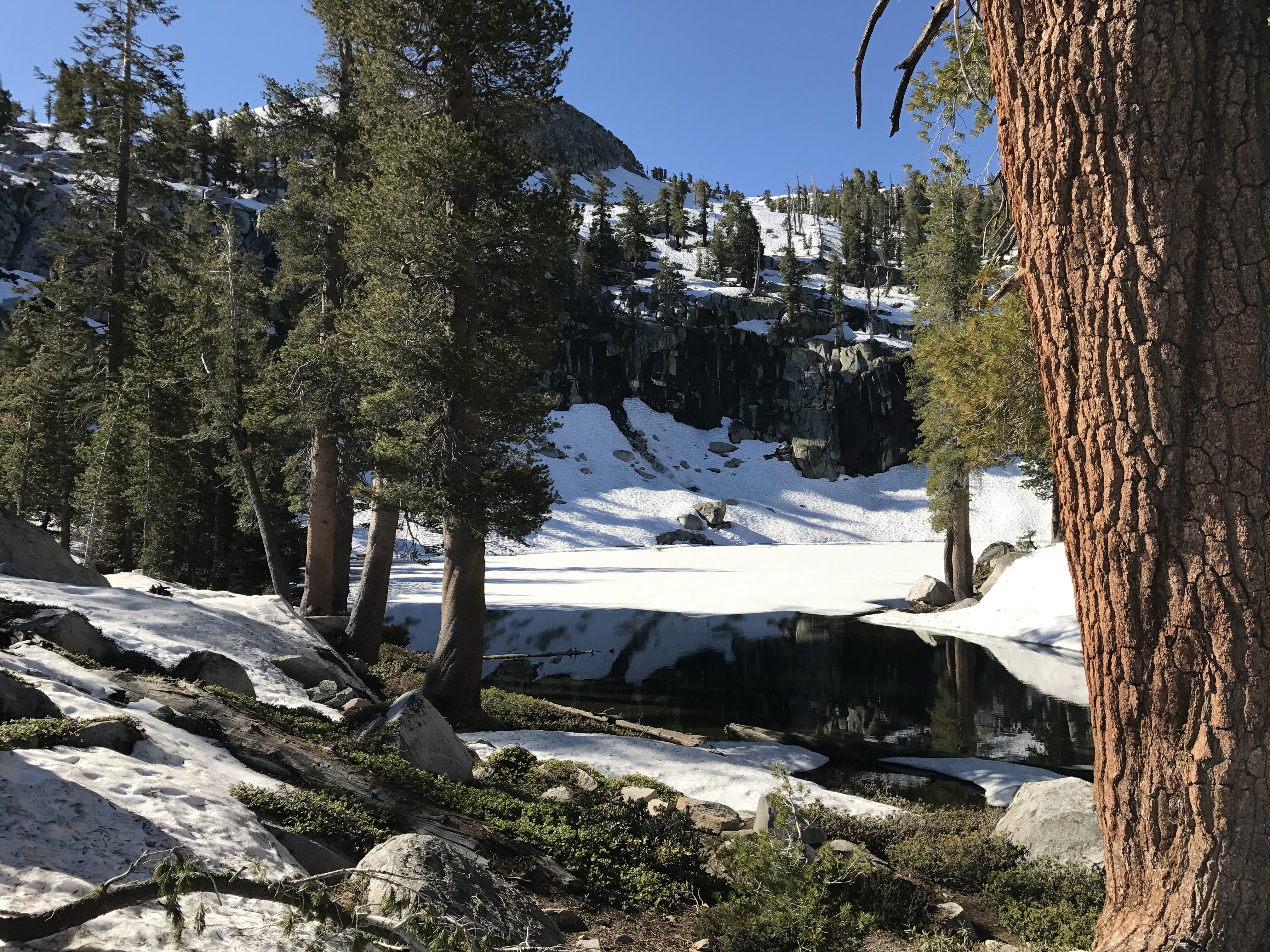
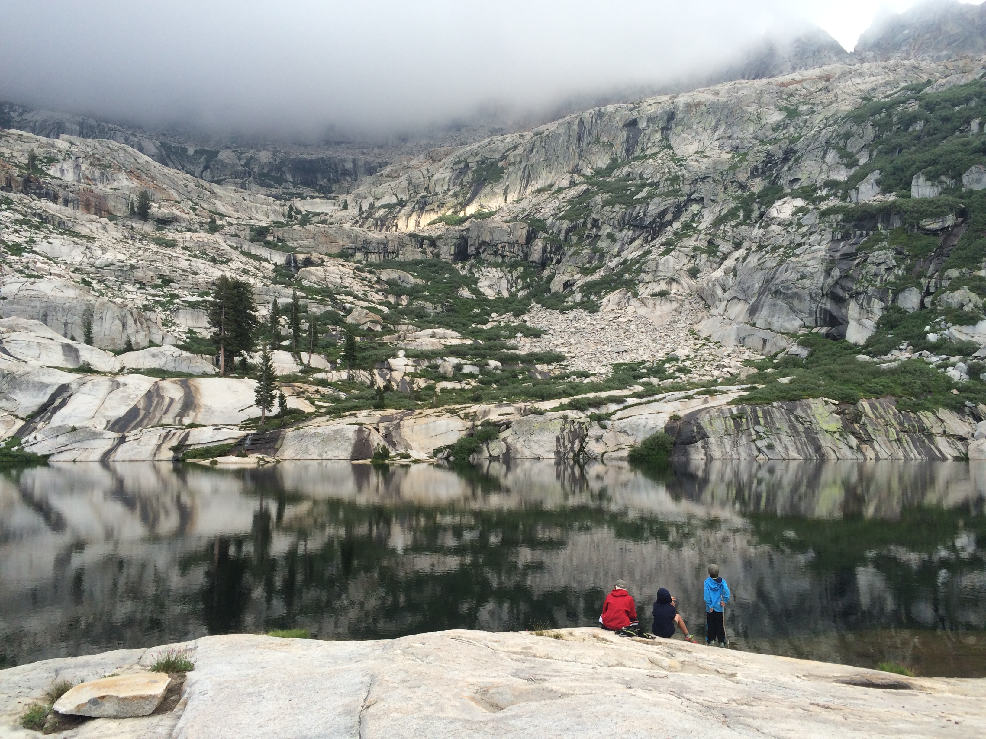
Just a few yards ahead was Heather Lake, half-frozen and mysteriously awesome. Of the three hikers ahead, one had already stripped down to shorts and got ready to jump into the chilly water. His shout was silenced by a splash. After a few seconds, he scrambled out, laughing. Without regret, he said he had become too dirty and sticky. He had to do it.
I walked slowly around the perimeter of the lake, admiring the translucency of the lake’s water and the opacity of the remaining ice. The bordering mountainside blended into the floating whiteness. I could only imagine how wonderful it would feel to swim in it in about two month’s time.
Limits
At this point, I was dead tired. Heather Lake is 2,000 feet higher than the trailhead, which was already 4,000 feet above sea level. Plus, struggling through the snow takes up lots of upper body strength. The jury was done deliberating. The verdict was to set up camp on the next ridge, which divides Heather Lake from the valley adjacent to Emerald Lake, which would be surrounded by even more snow. Emerald, Aster, and Pear Lakes would all have to wait until another time.
And it wasn’t bad either. To say the truth, the views from this ridge were stunning and immense.I started to set up my tent on the soft snow when two more hikers showed up, two young men who had the build of waterpolo players. They were wearing shorts, t-shirts, and mountain running shoes, and only carrying the most compact of backpacking packs. I said hi and asked them if they were cold. They looked at me incredulously and asked me why I wasn’t heading to Emerald. It’s only a mile or so away, they said. The forest clearly behold many animals, even a variety just within the human species. When I told them that I was exhausted, they hunted around for a better place for me to set up my tent and found one a bed of pine needles, softened by freezing and thawing and propped up by a single vigorous pine. No sooner did I thank them did they start skipping down the mountainside of snow. I relocated my gear and started to put together my kitchen, on a cluster of big rocks. It’s best to eat before sunset, as things get harder to see and the temperatures start to drop.
The good thing about camping around snow is that you don’t have to hike down to the river to get water. The water is everywhere! You just have to melt it. As I enjoyed a cup of green tea, I boiled more water to make mac-n-cheese from a box. Adding some real cheddar and powdered milk, I made it extra rich. It was soooo yummy! It was the most satisfying meal I’ve had in a long time. After eating a sizable serving, some celery and carrot sticks, an apple, and a piece of chocolate, I boiled yet more water for a sponge bath and finally completed the toiletry rituals. All food and fragrant things had to go into the bear canister, which got shut tight and crammed into a crevice. At last, I rolled into the tent about the same time that the last bits of light retreated from the sky. I spread out my spent limbs. The bed was so soft and relaxing. Sleep came in no time.
Sunrise
The next morning about 6am, bird chirps and the first sunrays woke me up. The bear canister was exactly as I had left it. My pots and cookware were undisturbed and now dry. I guess no quiet visitors came last night. That’s nice. Knowing that I had to catch the Sequoia – Visalia shuttle from Giant Forest in the late afternoon, I did not laze through the morning. A breakfast of fresh coffee, more mac-n-cheese (it was so good), and fruit materialized pretty quickly. I broke down the tent, consolidated all equipment and took a moment to make sure to leave no trace. This location had served me well and I gave it a little prayer of thanks.So longThe return hike up the mountain of snow was much harder than I thought. It’s like three steps forward and 2.5 steps worth of sliding back down. After trying this a few times, I realized that it would totally exhaust me without reward, so I devised another plan. Given that there were scattered dry spots, I made freestyle switchbacks between them and eventually zigzagged my way up the mountainside. The only problem was that now I was completely off the trail. I had no idea where it was anymore. Time to consult the compass and the map. Hmm, I could hike in the trail’s general direction. After about 200 feet of cutting through bushes and branches, the brightness of a magenta silk rose on the sunhat of a woman hiking with her husband caught my eye. I waved to her and shouted that I couldn’t find the trail. She stopped and pointed it out. All order was restored. They were heading in a different direction and zipped away. (I’m always impressed about how my presumptions about age and diminished vitality are continuously dashed.)
Hiking downhill was much easier than hiking uphill, though the knees and the quads work harder to stay engaged. Be that as it may, at last, I could thoroughly take in the scenic richness of this trail, without concentrating so much on breathing and energy flow. I saw fur-fluffed marmots, wild grouses, lots of chipmunks, and even a lithe doe, who carried on feeding upon moss without a care about my presence. The early morning and quietude offered so many precious encounters. On the way down, I met a solo hiker with a surfer”s aura in his late 40s, who proclaimed he was from San Diego and explained that he loved doing solo hikes, including 160 miles over nine days along the Pacific Crest Trail between Yosemite and Inyo. I asked him if he ever got nervous. He said that he trusted his judgement and found exceptional fulfillment in communing with abounding nature. He recommends it to anyone with the physical strength. I looked at his wiry and moderately muscular build, his wild hair, and the leatheriness of his skin. This guy was the real deal. Another remarkable variety of the human species.And it was Friday, the gateway to the weekend, and the stampede of hikers was on its way. For example, a 14-member squad of the Sierra Club hiked past me. Whole families with preteen kids, receiving hands-on inculcation into the ways of the outdoors. They are lucky!By 1PM, I arrived at Wolverton trailhead. Such a surprisingly quick trip back! I had to return my bear canister to Lodgepole and then go to Giant Forest to catch the Visalia shuttle, but greed, untamable greed, intercepted me and I hard-lefted to the Giant Forest grove to be surrounded by the Sequoia Trees. I’ve been to this park before, so I thought I could bypass this familiar grove but I still really wanted to see them one more time. It never ceases to amaze me how these powerful and gigantic creatures originated from a small seed in the soft earth. Over the course of thousands of years, they soar towards the sky. They are truly magnificent and mesmerizing, no matter how many times I see them. My silent reckoning with their telluric persistence seguéd to the brevity of my own, by comparison.
Back to Civilization
Alas, shuttle I must catch, and downhill to Three Rivers we rode. It was still hot as hell down there. Though initial plans involved staying one more night at Kaweah Oaks, I felt at this point I would much rather drive the three hours or so back home to Pasadena, take a shower, and sleep in my own bed. I did exactly that, passing by farmlands and fracking fields. It was weird to face the terrain of very evident human influence after being in the forest. I guess we need to do this to survive, or do we? As much as I tried to minimize waste and take public transportation at Seki, the ridiculousness of me driving 200 miles to a location, just to hike nine miles — it”s nuts. To make it worth it, I need to make it a longer trip next time, and bring friends. And that might even actually be more fun.
On Solo Backpacking
My assessment of solo backpacking now is that it is overall good. One must have one’s calm, wits and resourcefulness about herself. One must also be ready to carry slightly more weight than when hiking with another. I’d do this again sometime. As for the being able to touch the water, I went a little early. I think late August or September may be better, insofar as the rivers will not be so pernicious and of a more soothing temperature for a good swim.
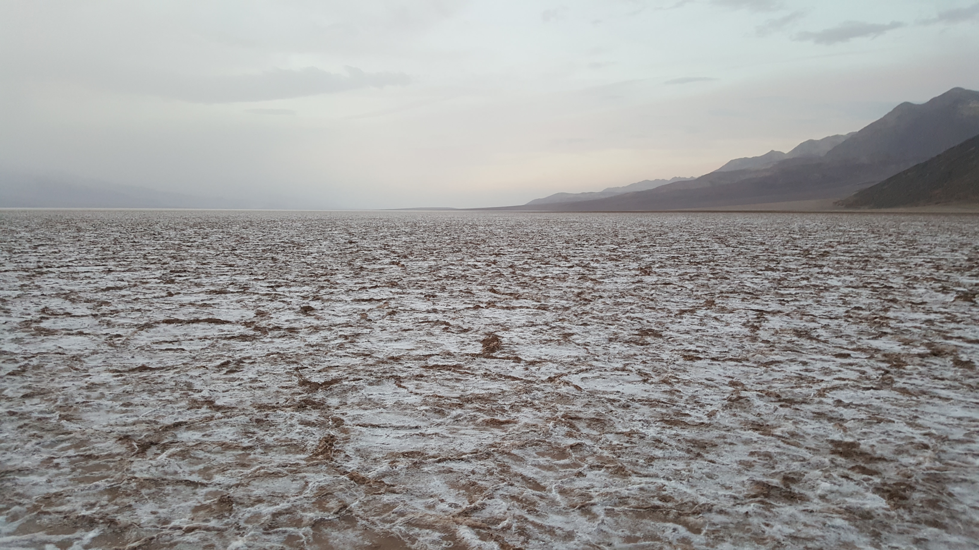
The desert is a strange place. It is where the hardiest of creatures can live and the rest just die trying.
A few Saturdays ago, I bit down on a long-lived desire to visit Death Valley. I recall my elementary school days, in geography class, seeing its outstretched name over a big swath of eastern California. Its largesse and meaning stoked a quiet terror in me. As an adult who”s been to Joshua Tree several times and a friend of a Coachella native, Michael, I”ve actually grown fond of the desert and have come to see the faded greens and strewn rocks as a fertile ecosystem for the small, stern survivalists on this planet. That which once inspired fear now inspires mesmerization.
Along the nearly 300 miles from Pasadena to Death Valley Junction, we encountered scattered settlements, towns anchored by familiar chainstores, conspicuous federal infrastructure facilities, and abandoned commercial enterprises riddled with graffiti. The latter fascinated us. They are remnants of grandiose dreams of vacation oases and of metaphysical healing spas for fleeing urbanites, now left to weather under an unswayed sun and through the erosion by prolific vandals.
That kind of visionary”s mirage is also what brought Death Valley into the collective consciousness — through mining. 10,000 of them. From borax to gold. All and all, unsuccessful with priceless costs. In the end, humans” attempt to claim nature”s gifts evolved into nature reclaiming her own gifts for humans to awe.
In the four hours that we had at DV, before heading back, we saw quite a few sites and realized that we would need to return again one day to see more.
There was a contemporary look to this stripped down, minimalist, barren scene. The nearly consistent light beige of the mounds and the hazy sky united in visual harmony. I remarked to Michael that this looked like an art exhibition, or that today”s art more and more takes note from the desert. I can”t tell if its minimalism is post-apocalyptic or pre-civilization. Well, if you ask Earth, these are one in the same, I guess!
I longed to see the real Artist”s Palette, after seeing a bunch of heavily photoshopped versions online. And here it was, at the most ideal viewing time of the day, sunset. The mountains swirled with color like a Rite Aid ice cream flavor. Artist”s Drive must”ve been the inspiration for Big Thunder Mountain at Disneyland. The roads dipped, swooped and turned in extremes in characteristic ways. Every turn brought another array and display of color in these barren mountainsides.
\r\nA display of tectonic dynamism, examples of undulating, collapsed and tossed masses of landscape of towering proportions, striated with multi-hued minerals variegated our every vantage point. I have never seen such extreme and stark tectonic results. A single stripe of color, a strata of rock layer, was visible across a range of mountains: at first horizontal, then zigzagging up and down, and finally ending up vertical — all denoting the kinds of buckling, bunching and colliding of earth that needed to happen in order to create it. The mountains were like frozen tsunamis of rock looming above us. None of it looked friendly but all of it was awesome. Nothing was gentle about this landscape. Its magnitude and grandeur conjured the greatest orchestral pieces in Michael”s synesthetic mind. As we left, the sun sank over the highest peaks. Haze shrouded the day and shut out all light at night. Outside my car, you could not see anything beyond one foot”s distance. It was dead silent and pitch black. For Michael, this totality summoned the most striking moments of every horror film he had ever seen (and that was a lot). For me, my backpacker”s wonderment was piqued by the extraordinariness of this phenomenon and the ecological qualities it afforded, especially in contrast to those heavily influenced by human activity. What a luxury this place is to nocturnal animals with supersonic senses and night vision. It is totally unpolluted by noise and light. I could indulge myself in this imagination, only because our paper map assured us that we were on the correct route!
Trepidation gave way to voracious hunger when the sparkle of city lights appeared in the windshield. At this point, Michael released a breath of relief, reassured by these beacons of civilization, and for second, we shared the probably the same sentiment as our ancient ancestors returning from a long wilderness journey on a much less human-inhabited earth, heartened to see the distant flicker of the tribal bonfire. It is a prehistoric feeling.It was nearly 9pm. How early all of the restaurants close in the desert! We drove all of the way to Barstow before stopping at an In-N-Out with copious seating for perhaps 70 but occupied by a motley 15. I regained vitality first with a hot chocolate while Michael went straight for the fries and burger. After refueling both the car and ourselves, I said to Michael, you can sleep now. I”ll drive. He said no. He would stay up and DJ an 80s playlist because our spirits still needed fueling. We sang to young Madonna, The Jets and Janet Jackson during this final stretch. Before we knew it, the 210 junction appeared and the whole day felt a lot like a dream.
Honestly, this trip should really be made in a minimum of two days, with overnight camping in the park. There was so much left to see, including the dunes, the canyons, and the kilns. DV also features an impressive Visitors” Center and Ranger Station, with a comprehensive museum and screening room about the history of the park. We had had to race through the exhibitions and forego the film. Many visitors were inside, including those in line for Wilderness Permits for backcountry backpacking. We did it all in one long day. Too much! It was more of a charter expedition to scope out the territory for a more in-depth and extended journey in the future. Rangers said that November is usually and ideal time to visit.


